
Severe thunderstorms moved across portions of the northwest metro area at mid afternoon yesterday. Photo above at 3:09 pm MST, just as storm was approaching the house. We had winds of 60 to 65 mph (my estimate), with some moderate to large limbs down in the area. Rainfall was very heavy from about 3:10 to 3:20 pm, and there was some very small hail mixed with the rain. It was the most severe storm here at house in quite a while, and there was 0.92 inches in the gauge this morning.

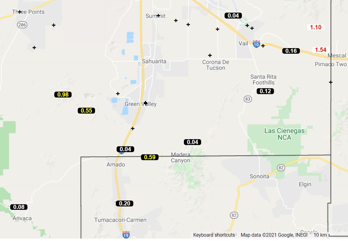
Plot of detected CG flashes (from Atmo and Vaisala - above) for 24-hours ending at 2:00 am this morning shows fairly widespread storm activity over most of southeast Arizona. ALERT rainfall amounts (below for north and south sectors) shows numerous sites with over half an inch and 7 sites with more than an inch.


The 500 mb pattern remains chaotic with light winds over much of the western half of the country - there is a weak inverted trough to our east that extends south across Sonora. The morning sounding for Tucson (below) continues very moist (PW of 1.82 inches!) and unstable, with the lifted condensation level (LCL) below 700 mb.


There is a large area of nearly clear skies to our southeast this morning, so there will be some sunshine to help trigger more storms later today. Forecasts from the 12 UTC WRF-RR indicate several waves of storms over eastern Pima County that extend well into the night. Forecast of radar echoes below is valid at 5:30 pm this afternoon. Getting heavy storms two days in a row is a rare situation, so I'll be watching carefully. Meanwhile I am still cleaning up from yesterday's downpour.

No comments:
Post a Comment