
Yesterday was totally suppressed in eastern Pima County, as expected after the event of the 10th. However, outflows from the south have brought us hazy/dusty skies this morning. Views here are of Catalinas from campus (above) and to east of Rio Rico (north of Nogales).


A very large MCS developed over northern Mexico, southeast of Cochise County (IR image above is from 0806 UTC) last night. Plot of detected CG flashes (from Atmo and Vaisala - below) shows 24 hours ending at 1103 UTC this morning. Activity with the MCS reached all the way to GoC. Gusty winds from the south impacted surface stations in southern Arizona as per: Ft. Huachuca 44 mph; Nogales 40 mph; Yuma 38 mph; and Tucson 31 mph. Nogales and Ft. Huachuca also had light rainfall with thunder.


Skies are mostly clear this morning across southern half of Arizona - visible satellite image above from 1506 UTC. Loops indicate an inverted trough (IT) over the central GoC.

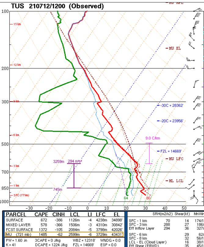
Morning analysis at 500 mb (above) shows the unusual anticyclone shifted westward to California/Nevada border - how long is it going to be stuck there? This morning's sounding from TWC/TUS (below) has considerable CAPE, but with a deep layer of cool air extending upward to just above 700 mb. Significant forcing needed for storms at low elevations, but thunderstorms will likely head this way from the White Mountains with strong gust fronts. Models indicate significant storms this evening for most of Pima County; should be another interesting event for our area.
No comments:
Post a Comment