Thursday, July 16, 2020
Summary Yesterday - July 15th
Although there were heavy clouds and anvils during afternoon yesterday (view above a bit before 3:00 pm MST), there was minimal thunderstorm activity near the metro area. Plot of detected CG flashes below (from Atmo and Vaisala for 24-hours ending at midnight last night) shows thunderstorm activity north to east to south of the city - almost a donut hole pattern.
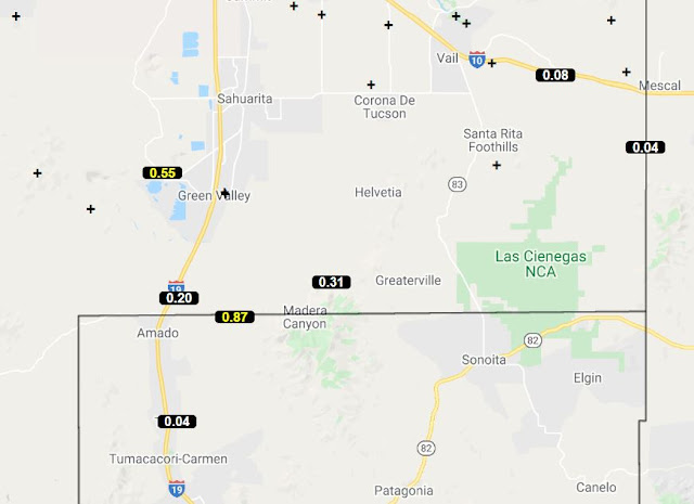
Across the ALERT network only 12 sites measured 0.04" or more (above and below for 24 hours ending at 6:00 am this morning). Three sites did have over half an inch - the site in the Catalinas may have been within the Bighorn fire burn scar, which would have made for nasty runoff.
Here at the house we had the slightest of sprinkles in the evening as decaying, thick anvil cloud from storms to the south moved by. All-in-all not much of a weather day for mid-July.
Subscribe to:
Post Comments (Atom)


No comments:
Post a Comment