
Running a bit late this morning. Nice reflections at Kitt Peak this morning (above).

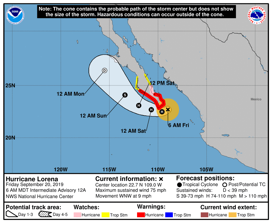
Hurricane Lorna (Cat. 1) is just east of the south end of Baja this morning (visible satellite image above for 7:00 am MST). Tropical Storm Mario is south-southwest of Lorna. The PW is high with and north of Lorna this morning (TPW analysis below is for 6:00 am this morning). Note that PW over the southern third of GoC is approaching three inches!
The current forecast track of Lorna (second below) indicates westward and then northwestward movement, keeping the weakening storm close to Baja. Once Lorna moves west of the south end of Baja, I'd expect a northward surge of low-level moisture up the GoC, due to rising pressures and strong winds at mouth of GoC. This should increase PW over southern Arizona sometime late tomorrow.


This morning at 500 mb (12z analysis above from SPC) there appears to be a closed low centered over the Bonneville Salt Flats. The WEST is completely dominated by this low and associated trough.
The 12 UTC TWC upper-air sounding (below) continues very dry (PW less than half an inch) with no CAPE. However when low-level moisture pushes into southern Arizona there will be increasing chances for thunderstorms.

Finally, I examined the QPF forecasts from NCEP WPC - the forecast below is for 24-hours ending at 12 UTC on Monday morning. Not at all impressive and I hope underdone. The center forecasts no precipitation this side of border for late Saturday. Also note the total lack of reflection of reflection of orographic effects in the forecast - in my opinion, a pretty sad product.

No comments:
Post a Comment