Thursday, September 05, 2019
Dry For Few More Days
Very suppressed yesterday with only some pancake cumulus around (above) in the afternoon. The plot of detected CGs below (from Atmo and Vaisala) shows almost no thunderstorm activity across a large portion of southeast Arizona.
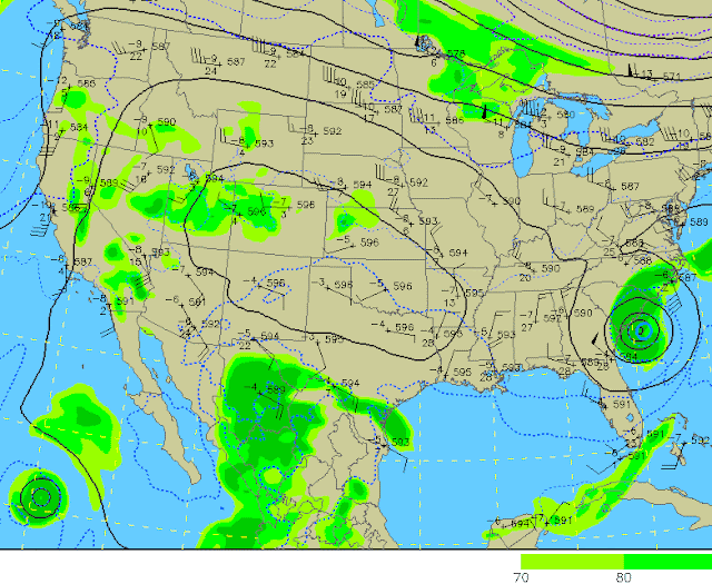
This morning's upper-air sounding plot for TWC (above, from SPC) indicates PW down to just less than an inch, with not a hint of any CAPE. The 12 UTC 500 mb chart (below, also from SPC) shows the main center of the large anticyclone to be over southern Colorado. Hurricane Dorian is moving up coast of Carolinas and Juliette is west of southern Baja and moving westward.
The total PW (above for 6:00 am MST) shows the drying over southeast Arizona. Moisture from the GoC extends northward across all of Utah.
The 06 UTC plumes for PW (above) indicate a rapid increase here, beginning this afternoon - presumably west winds will bring the moisture over southwest Arizona back toward our area.
The 06 UTC GEFS plumes for QPF at airport (below) show storm activity beginning over the weekend here and continuing into midweek next week.
Subscribe to:
Post Comments (Atom)


No comments:
Post a Comment