
Bit of cloudiness with slight colors over the Catalinas at 5:15 am MST this morning.

Yesterday was quite suppressed with respect to thunderstorms - plot of detected CG flashes (above from Atmo and Vaisala for 24 hours ending at 0103 am MST this early morning) shows our area almost lightning-free with exception of a cell over western Catalinas.
ALERT chart for 24 hours ending at 7:00 am (below) shows that what showers there were concentrated over the Catlinas and Redington Pass. Only two sites in network had a bit more than half an inch - note that not shown on plot are 0.55" at Arivaca and 0.08" near Elephant Head (both in southern part of network). It was dry day here at the house.

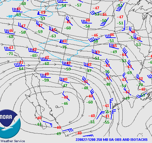
The 500 mb level remains a mish-mash, but the morning 250 mb chart (above) shows the upper-tropospheric anticyclone shifted down over southern Sonora, with distinct westerly flow over Arizona.
Morning sounding from TWC/TUS (below) continues moist with potential CAPE, but drying has occurred above 600 mb. The westerly winds aloft are quite unfavorable for storms here.


Forecast above is from the 12 UTC WRF-RR and is for rainfall through midnight tonight - note the distinct donut hole centered near the airport.
As the dry-out continues this week, PW values fall below an inch, which is the lowest level in weeks. Forecast of TPW (below) is from the 00 UTC WRF-GFS and is valid at 7:00 pm on the 29th.

No comments:
Post a Comment