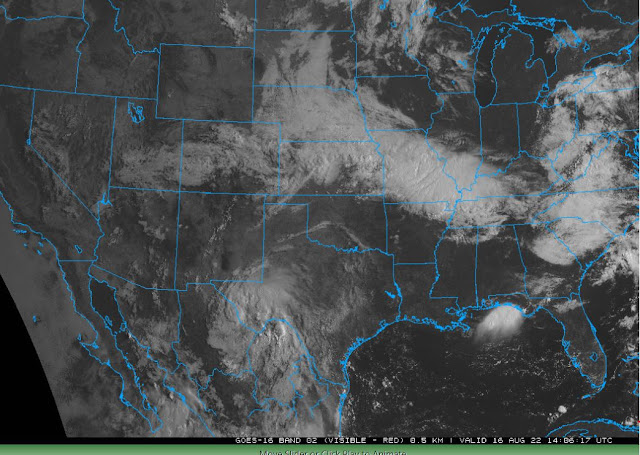
Visible satellite image (above from a bit after 1400 UTC this morning) shows the approaching tropical system over the Big Bend country of Texas. The image seems to indicate a closed cyclone rather than an open wave, but there are not enough upper-air data to say for sure. Regardless, it is a tropical system with strongest winds in the lower troposphere and weaker winds at high levels. This system will begin impacting southeastern Arizona tomorrow.
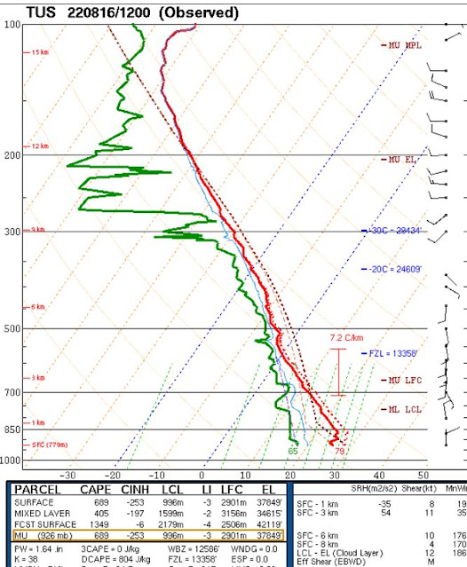
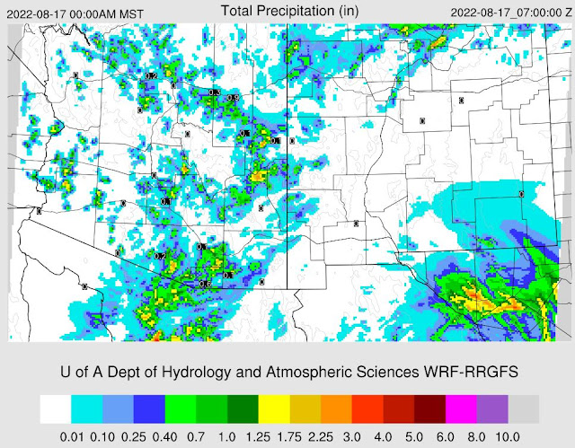
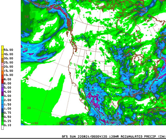
This morning's sounding is similar to past several days - moist with some CAPE and a light and variable wind profile. The 12 UTC WRF-RR does forecast some precipitation inching toward the metro area this afternoon and evening - forecast below shows total rainfall through midnight tonight. Forecast from the 06 UTC GFS (second below) shows that model's forecast of total precipitation through 5:00 pm Saturday afternoon.
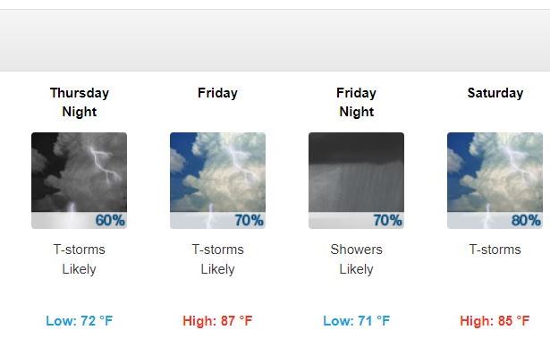
Bottom two panels show the current forecast from the NWS Forecast Office. This is quite an aggressive forecast with POPs of 60 to 80 percent each forecast period from Wednesday night through Sunday. Since we're dealing with convective storms, it will be interesting to see how well this wet forecast verifies.

No comments:
Post a Comment