
View of the Catalinas from campus at 6:00 am MST this morning.

Thunderstorms were quite isolated yesterday. In Pima County there was a storm on the north slopes of the Catalinas and another west of the Santa Ritas. Storm activity extended into both Pinal and Santa Cruz Counties - as per plot of detected CG flashes through 0903 UTC (above - from Atmo and Vaisala). All-in-all it was mostly a down day, as per WRF forecasts.
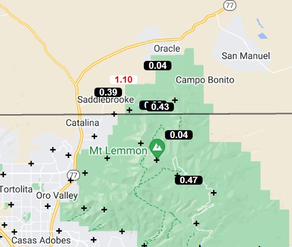
Only two small areas with rain reports across the ALERT network - see above and below, as well as the CG plot.


At 500 mb this morning the anticyclone is centered over the White Mountains, with warm core temperatures of -4 and -5 C. There's a somewhat unusual west-to-east trough across northern Mexico, where temperatures are cooler. This feature is forecast to weaken and shift southwestward, thus it won't be a player in our weather the next several days.

The morning sounding for TWC/TUS (above) is quite moist, with considerable CAPE. However, if the BL heats out to 750 mb (as it did yesterday), there is a capping layer that was enough to keep activity mostly suppressed. This what the 06 UTC run of the WRF-GFS forecasts again today (below is model's forecast of rain through midnight tonight).

No comments:
Post a Comment