
Heavy cloud cover over the metro area this morning, with a band of stratus along the foothills. View was at 6:47 am MST, while there was light rain falling here at house.

Plot of detected CG flashes (above, from Atmo and Vaisala for 24-hours ending at 0733 UTC)) shows that there was little lightning during the afternoon and evening over Pima County, but storms were very active on east side of Rincons.
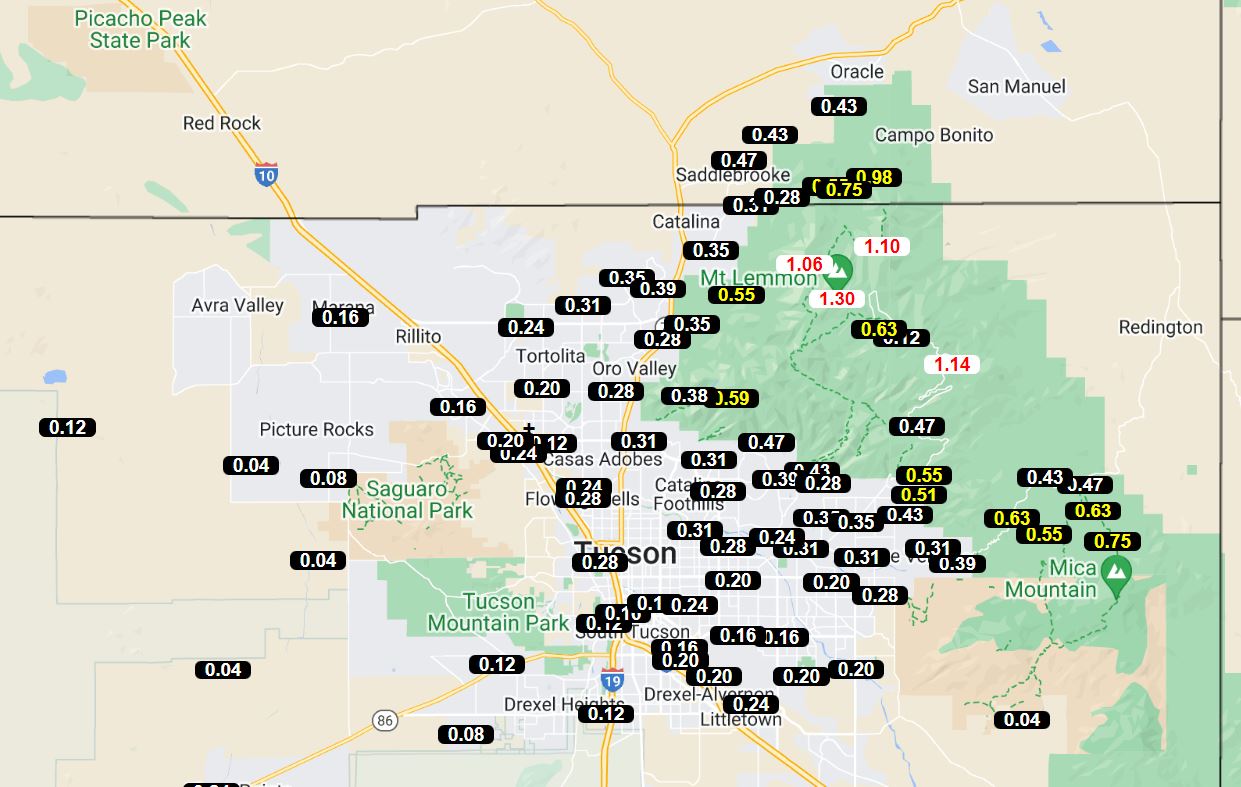
ALERT rainfall reports for 24-hours ending at 6:45 am this morning - above and below. There were three reports of over an inch at lower elevations, south of the Rincons. Here at house we had 0.32" (0.09" yesterday morning and the rest after midnight this morning); Atmo reported 0.28"; DM had 0.25"; and the airport reported 0.21". This was a widespread event, with almost all the ALERT sites reporting 0.04" or more.


The 500 mb analysis above (from NWS SPC webpage) continues to show the large anticyclone dominating most of the lower 48. Note the bad analysis that places the center of anticyclone over eastern New Mexico - actual center clearly in southern Colorado.
Below is the NWS morning forecast for the airport - the showers have already moved away to the northwest and skies are clearing here. Forecast indicates an increase in storm activity over the coming weekend.

No comments:
Post a Comment